Sandra Marquez
Projects
Design
Geographic Information Systems


This script in Python generates uniform random points on each atlas square. Integrates points surveyed completed in atlas 2 (2000-2005) and generate points up to a maximum of 40 points by square (10 km2). The lowest numbered 15 of the original points are flagged as priority and the remaining points are randomly renumbered.
Automated the process of generating statistical random survey points using Model Builder©, a visual programming language for building geoprocessing analysis. Provided formal documentation.
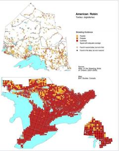
Translated an AML script to python code. The script generates atlas maps in a high quality PNG images ready to use in the Atlas website. Provided formal documentation.
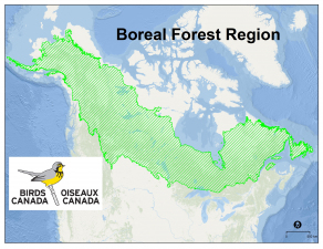
Wrote code in Python to automate the creation of composite maps by overlaying the relative abundance of selected species in raster format. This script uses an array, statistical percentile, reclassifies abundance and, sum rasters. Provided formal documentation.
ONTARIO BREEDING BIRD ATLAS 3rd EDITION
NEWFOUNDLAND BREEDING BIRD ATLAS
AUTOMATION
WEB-READY MAPS OF BREEDING EVIDENCE
BOREAL FOREST SPECIES RASTER OVERLAY AUTOMATION
